Towards the end of last year I enjoyed the hospitality of friends in the North East and had a very nice time indeed.

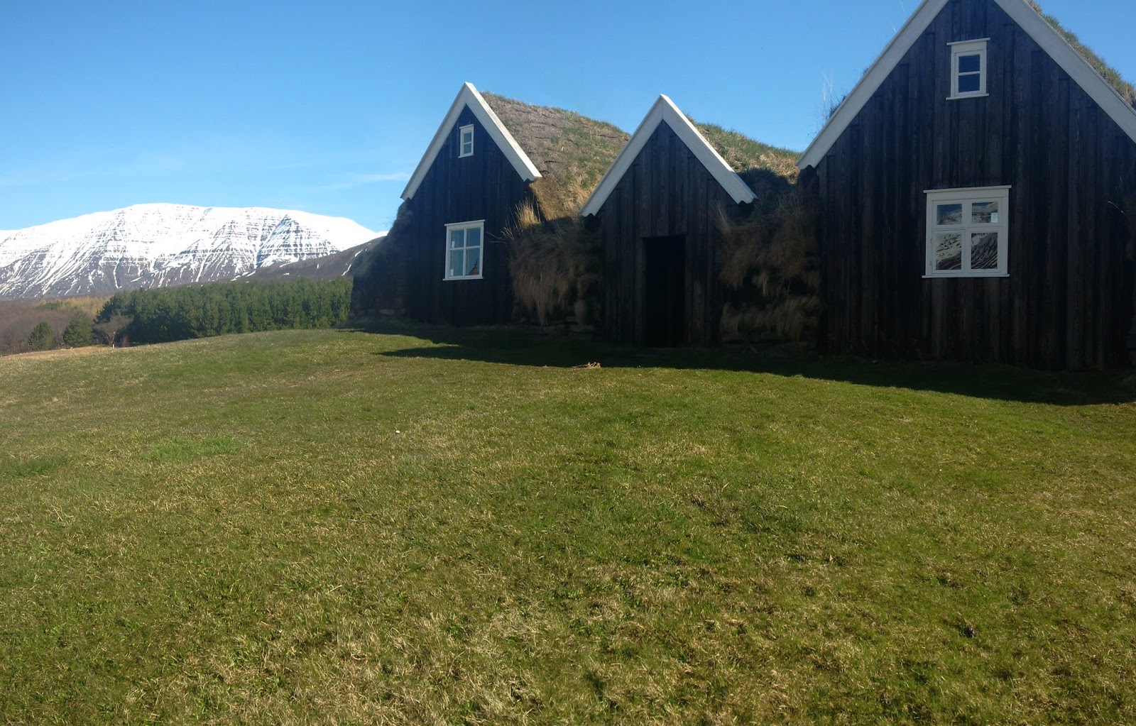
Even though the days may be short, there can be a long and atmospheric twilight after sunset. On clear nights the stars and moon give light and the snow reflects it. The house on the left is where I wrote the first post in this blog a year or so ago. The house on the right is its predecessor, an attractive (but now derelict) early 20th Century tin house.
The Neighbours. In the distance can be seen the town of Kópasker.
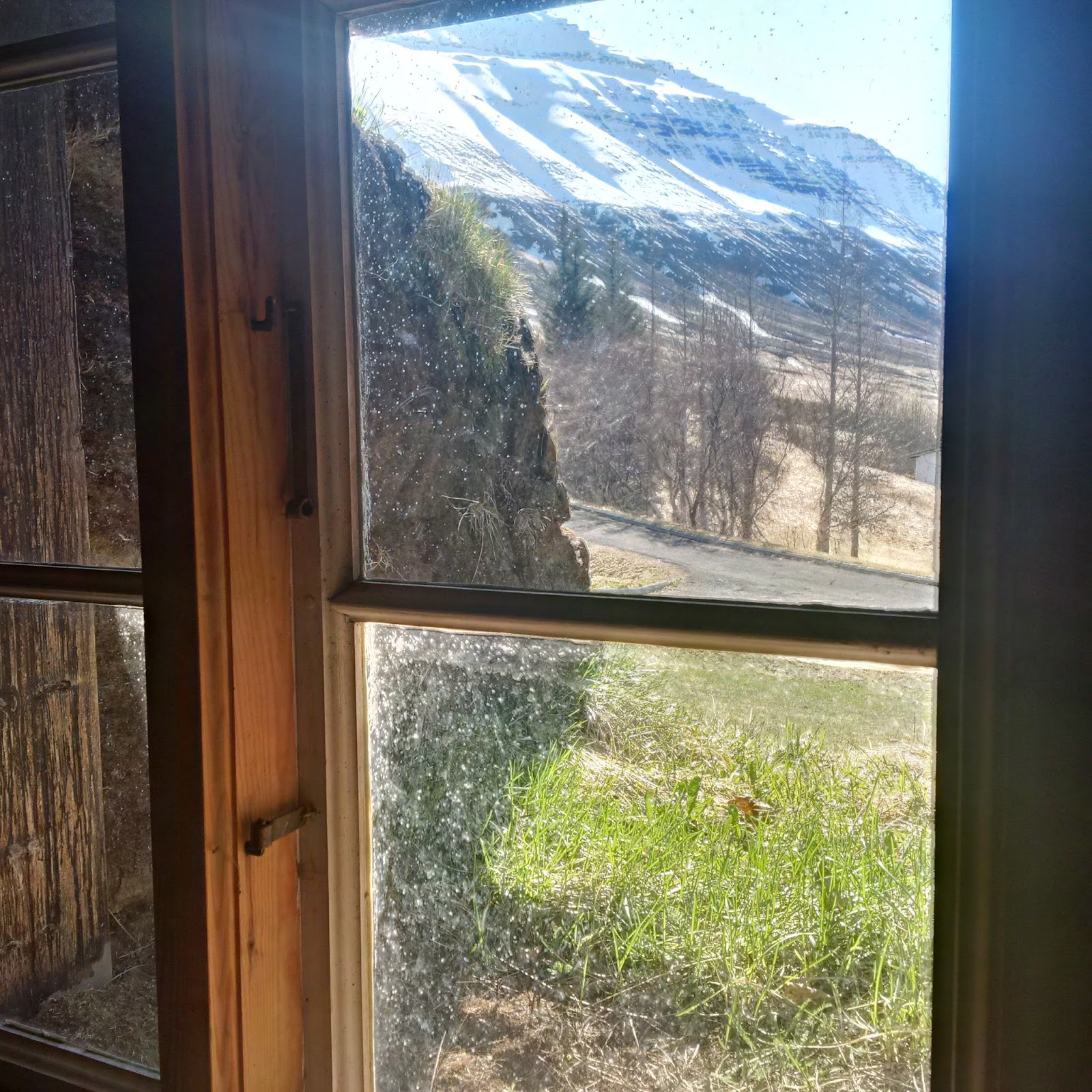
A daytime view of the same row, viewed from the back door
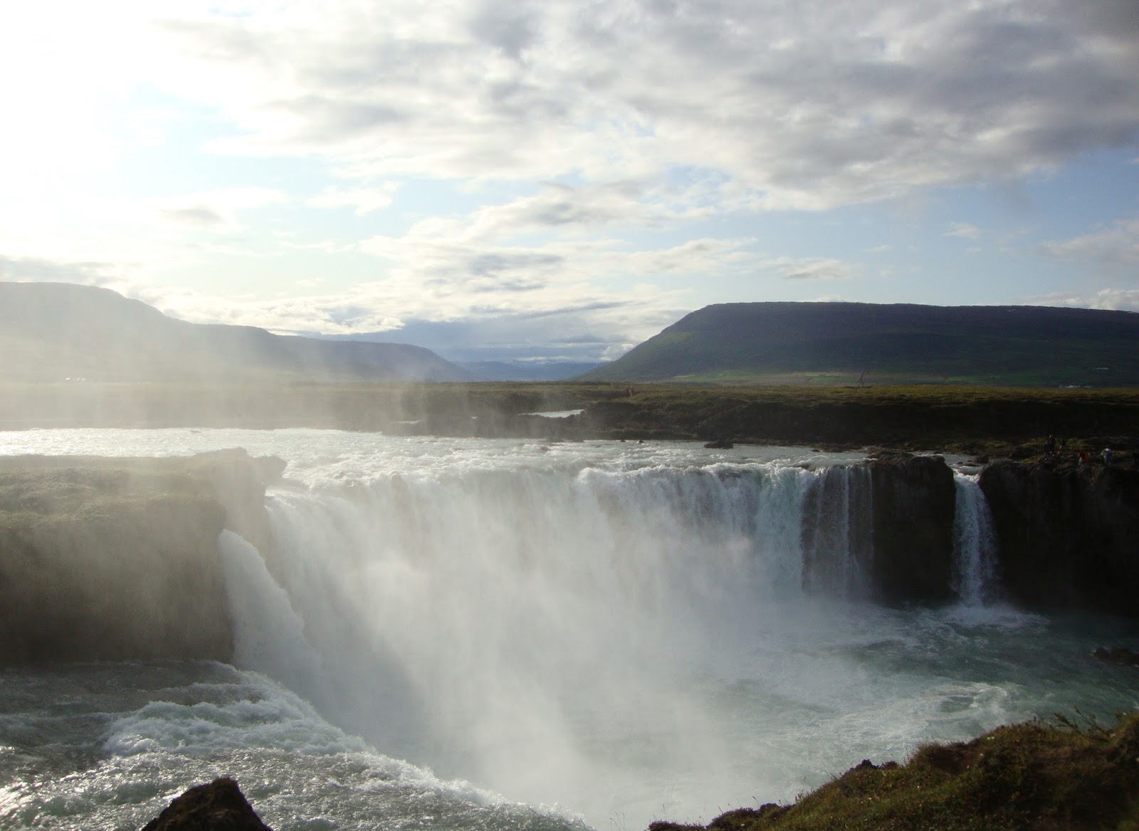
Spray rising from dettifoss, Europe's most powerful waterfall, in afternoon sunshine...


...seen as we travel down the east side of jökulsárgljúfur.
And ahead, to the south, is the iconic mountain herðubreið, with its highly distinctive outline, caught here in the last rays of the afternoon sun.
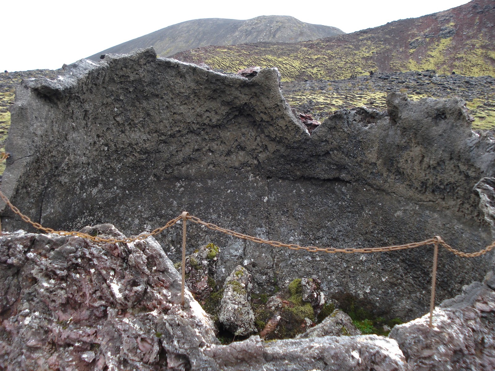
jökulsá á Fjöllum, a powerful glacial river, emerges from beneath the vatnajökull icecap and flows 206 km north to the Greenland Sea, with three great waterfalls on the way, dettifoss being the biggest. jökulsárgljúfur is the gorge through which it flows. On the west side of jökulsárgljúfur is vesturdalur. In the area around vesturdalur can be seen the results of spectacular events in the not too distant past. Up until about 8000 years ago violent glacier bursts (jökulhlaup) exploded out from the icecap at regular intervals, sending irresistible surges of water and ice downstream, tearing up the landscape.
 |
| Vesturdalur |
The camp site at vesturdalur is a good centre for exploring the spectacular scenery of the area. In the right of the picture is the Ranger's hut at the campsite, closed now for the winter.
In case you are getting a bit chilled by all these winter images, here's a picture of the gorge in July.
Here the farm's horses feed on the hay we have brought out to them. They stay outside through the winter, growing thick coats to protect them from the weather.

Melrakkaslétta
 |
| Melrakkaslétta, shown in purple |
The sheep from the farm graze across the area known as Melrakkaslétta, a moorland at the far north eastern tip of Iceland, reaching to within a kilometre or so of the arctic circle. Its name means the fox's plain.
 |
| Maybe not to everyone's taste, but I love it. |
At the northern tip of Melrakkaslétta is the hraunhafnartangi lighthouse, the most northerly one in Iceland.
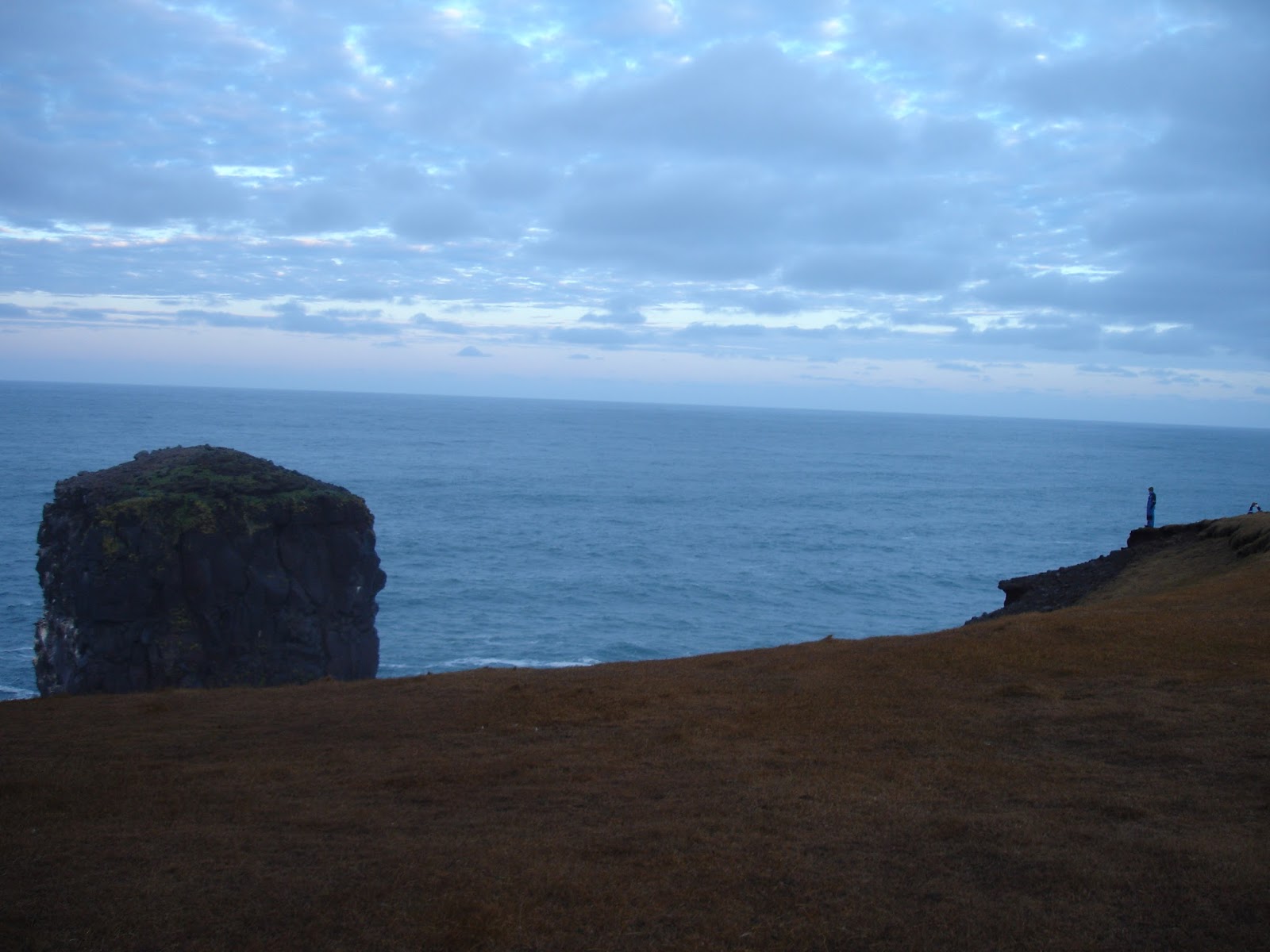
Not far to west of there is rauðinupur cape with its two great stacks rearing up out of the sea, another lighthouse and an old volcano.


Even here the birds are not entirely alone. There is a farm whose gate is the access point to the area, which is protected as a nature reserve. By the gate is a guest book for visitors to sign.
It's a beautiful and atmospheric place. This link is well worth looking at to find out more.
https://guidetoiceland.is/connect-with-locals/regina/raudinupur-cape-and-the-two-sea-stacks
In winter the sheep are brought inside and fed on hay which has been harvested during the previous summer.
Here's Whyswhys pretending to be a farmer.
After which, a dip ...
... in the Nature Baths hot pool near Mývatn.